
This blog post is about a Montessori study of our school’s home place: Downtown Norfolk, VA. Being a Montessori study, it is an active process of learning through participation.
David Kahn, the leader of the Montessori adolescent movement, writes that, for Montessori middle and high schools,
“[p]lace inspires belonging. Place inspires history. Place allows responsibilities to arise within the perimeter of that place where students develop ownership…Pedagogy of Place requires that the adult and adolescent dig deeper, look at the flow of energy, the economy of the village, the waste management, human needs (both material and cultural), the role models that keep any community healthy.”
In the following text, I am going to tell you about one way our school realizes David Kahn’s pedagogical vision. We have become part of Downtown Norfolk’s urban revival. You will read about the historical Downtown building that has recently become our school’s new permanent home. You will be introduced to new partnerships we have formed with two Downtown Norfolk organizations: The Virginia Stage Company and The Downtown Norfolk Community Garden. Finally, you will get a teaser of a future blog post about our contribution to the formation of new public memory that recognizes Downtown Norfolk’s part in the dark chapter of the domestic slave trade.
But before getting to our study, let me tell you briefly about the context of our place.
The Historical Landscape of Downtown Norfolk
Origins
Downtown Norfolk is a 43.3 acres of urban district built on land and landfill. It is surrounded by the busy waterway of the Elizabeth River. Flood-walls and levees protect the land from the tidewater of the Chesapeake Bay watershed. Until the 20th century, the Downtown area comprised most of Norfolk’s territory.
The native-American origins of the area are not recorded; the colonial-American ones go back to the early 17th century. The Norfolk City seal mentions three incorporation years: town 1682, borough 1732, city 1845.
The larger perimeter of Downtown Norfolk is made of seven intertwined cities in southeast Virginia. Most locals call it, nowadays, Hampton Roads. The older generation still refer to it sometimes as Tidewater.
The distant historical landscape of Downtown Norfolk is now quite invisible. The reason is that the area has gone through so many formative, even to say painful, events in US history. In a typical way to humans, city planners have sought remedy to problematic memories by transforming the urban space. Not only buildings but entire blocks, streets and even wetlands have changed dramatically.
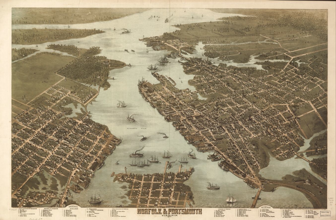
A drawn aerial map of Norfolk (right) and Portsmouth (left) ca. 1873
Peak
The rapid industrialization of the post-Civil War era sparked in Norfolk – an old port city – an economic boom. That happened mostly in the first half of the 20th century. The First and Second World Wars turned the entire Hampton Roads region into an international military center.
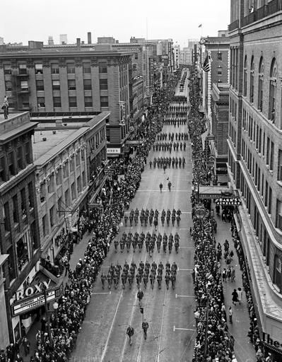
Norfolk’s annual Armistice Parade going up Granby Street, November 11, 1940
Decline
Like other US urban centers, Downtown Norfolk went through a decline in the second part of the 20th century. Many middle class residents responded to post WWII suburbanization and racial desegregation by moving to the single family houses in the new Norfolk neighborhoods and, later, Virginia Beach and Chesapeake.
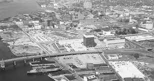
Aerial view of Downtown Norfolk in 1966, after the demolition of most of its eastern part
Revival
Starting from the late 1980s, the City of Norfolk began to envision a new relevance for the area. Two important engines of growth came a decade later. First was the construction of the Norfolk campus of Tidewater Community College (1997). The campus stands on the previous location of The College for Ladies building on 315 Granby St. The second engine was the construction of the MacArthur Center (aka the Mall) on 300 Monticello Ave. (1999), adjacent to The MacArthur Memorial.
Almost four decades later, Downtown Norfolk is now a busy center of business, military, cultural, entertainment and educational establishments. It is also becoming part of the new trend of returning to urban-style living. Office and industrial buildings converted into fashionable apartments and condos have especially drawn more affluent residents. A large-scale construction of a new residential complex on St. Paul Blvd. is geared to more mixed income residents. Hopefully, it will include the people who lived in the housing project that formerly stood on that land: Tidewater Gardens. The McArthur Center is yet again at the center of change. City leaders seek to adapt it to the currently emerging trends of 21st century shopping and entertainment.
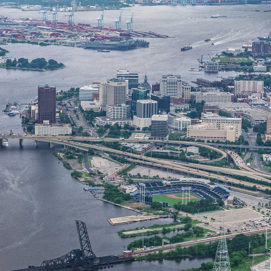
Aerial view of present-day Downtown Norfolk
Granby Street
Just around the corner of our building stretches Granby Street as the spine of Downtown Norfolk. This and its bordering streets pride with a turn of the 20th century architectural beauty. There are a handful of nearby buildings that go back to the late 18th and 19th centuries.

Granby St., ca. 1930s
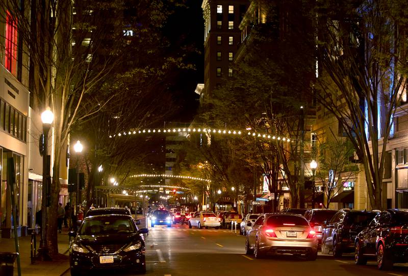
Granby St. at night, 2022
Our Active Study of Downtown Norfolk
Moving to Historical Downtown Norfolk
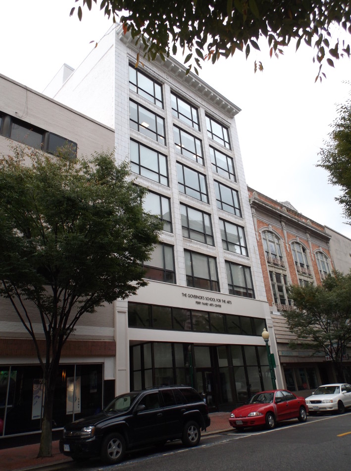
Since its foundation in 2014, Roadstead operated in two temporary locations within walking distance from Downtown Norfolk. That allowed us to come often to the neighborhood for different school activities. We earned the opportunity to become part of it in 2021. We decided that the time had come to buy a building for Roadstead.
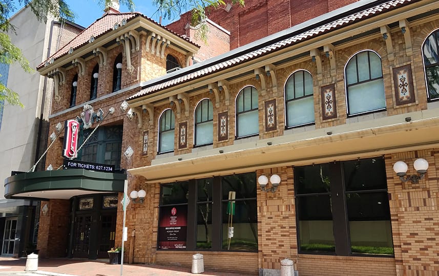
After a short search, we identified a historical property on 112 College Place, adjacent to the Tidewater Community College campus. The original exterior and interior architecture of the building was stunning. But it was clear that much renovation was needed in order to bring back its initial beauty and functionality. Among the planned improvements, installing a glass movable partition would enhance the flexibility and aesthetic appeal of the space. For many potential buyers that was a drawback. For us, it was a once in a lifetime opportunity. After nearly a year of deep construction work, we opened the 2022-2023 school year in our new home.
The new Roadstead building was built in 1913 for the Norfolk chapter (no. 38) of the Elk’s Lodge. It replaced the original building that had stood in the same location since 1872. Its planners were the leading Norfolk-based architects Finlay Forbes Ferguson (1875-1396), Charles James Calrow (1877-1938) and Robert Edward Lee Taylor (1882-1952). Under different partnerships, they designed many local residences, churches, commercial buildings, university campuses and government facilities all over Virginia.
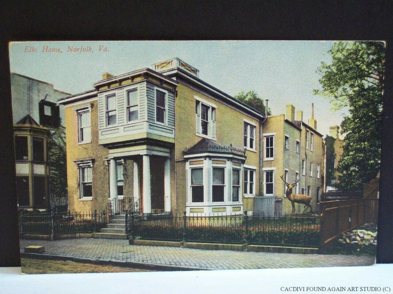
A postcard drawing of the original Elk’s Lodge building, ca. 1870s
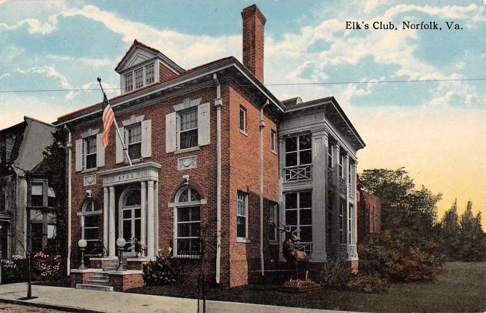
A postcard drawing of the second Elk’s Lodge building, ca. 1910s
The building changed hands a few times after the Elk’s Lodge sold it in 1966. It became a Men’s club, an art gallery, an upscale French restaurant and finally a lawyer office (first floor) and an advertising company (second floor).
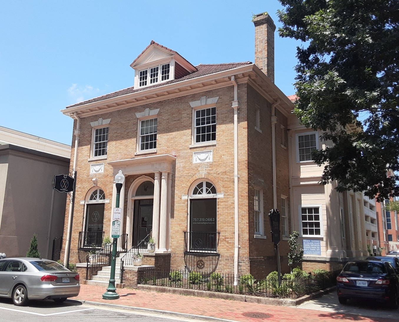
The new Roadstead building, 2023
A short walk from the Roadstead building through Granby St. brings our students to three work-study locations.
Virginia Stage Company
The first is the Wells Theater on 108 E. Tazewell St., the home of the Virginia Stage Company, the leading professional repertoire theater in Hampton Roads. This beautiful turn of the 20th century building is one of the earliest catalysts in the revival of Downtown Norfolk. Built in 1912, The Wells Theater originally hosted vaudeville shows, later turned into a host of popular musicals. Between 1960s and mid 1980s it became a venue for X-rated films, burlesque shows and a bar restaurant. The building entered a new phase in 1986, when the Virginia Stage Company purchased and historically renovated it.
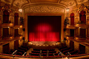
The Wells Theater, exterior (above) and interior (below)
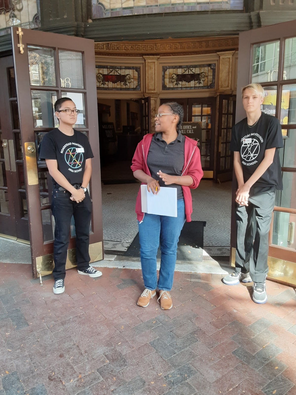
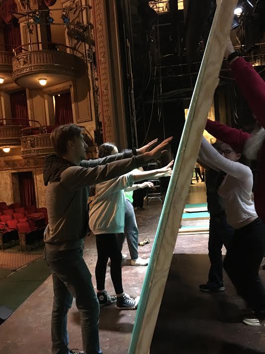
Our new partnership with VSC means that the students work at the theater alongside the backstage crew. During the school year, they assist with the creation of stage sets, costumes, sound and lighting. Additionally, our students serve as ushers in school matinees.
Our partnership with VSC is a new addition to the theater’s strong collaboration with the Governor’s School for the Arts. GSA moved in 2014 to another historically renovated turn of the 20th century beautiful Downtown landmark. This is the Monroe Building on 254 Granby St. (located between our school building and the Wells Theater).

GSA building (above), formerly Monroe building (below)
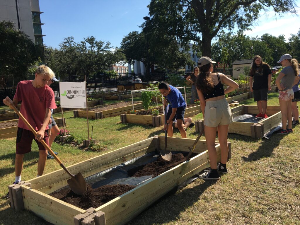
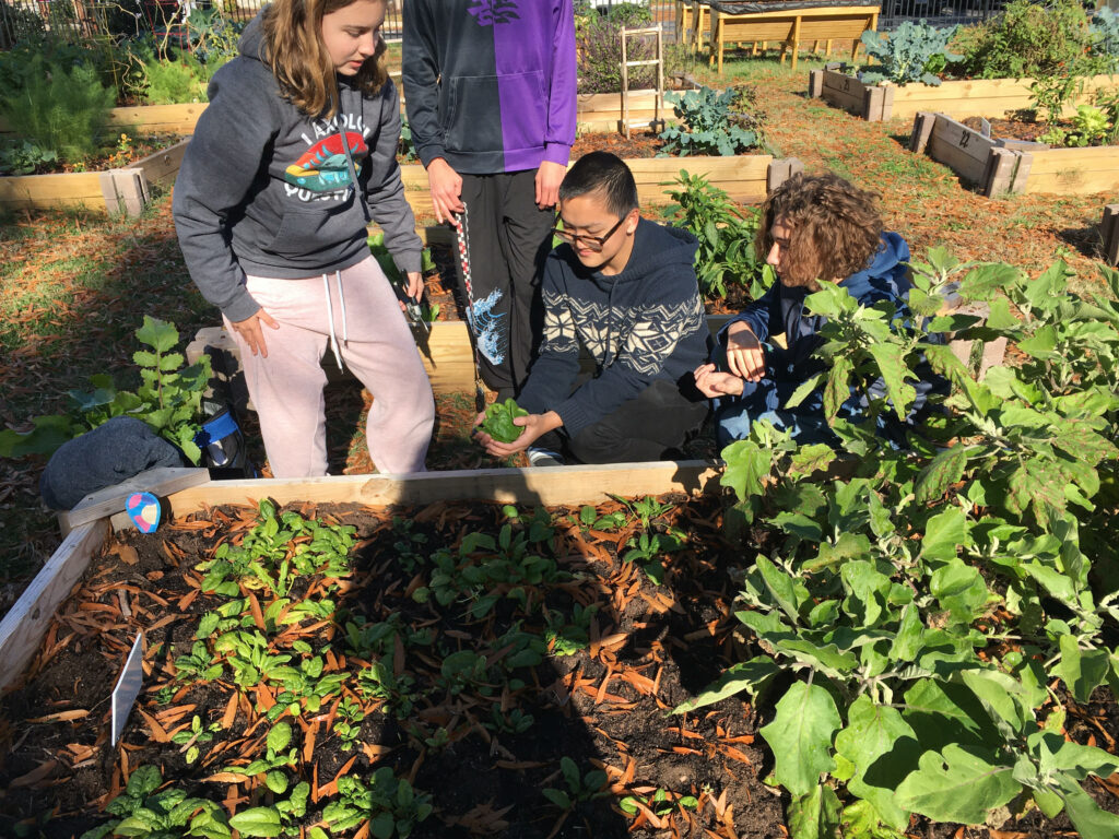
Downtown Norfolk Community Garden
This second work-study location is adjacent to The Freemason Street Baptist Church on 400 East Freemason St. In 2022, the church offered its land to a new initiative of developing urban agriculture in Downtown Norfolk. This is one of most recent initiatives of this historical church (founded 1848), which has continuously been a center for social justice, from racial integration to gender equality and taking care of the homeless. In addition to learning how to grow fresh food, the students take part in the attempt to end Downtown Norfolk’s state of being a food desert.
The Slover Library
The third work-study location stands a few blocks toward the waterside. It is the regional archive of the Sargeant Memorial Collection within the gorgeous building of the Slover Library. This is Norfolk’s main public library on 235 E Plume St. Built 1898-1900, the library building was previously the City Hall, US Post Office and Court, and Seaboard Building. It received new life in 2014 with an additional new steel and glass extension.
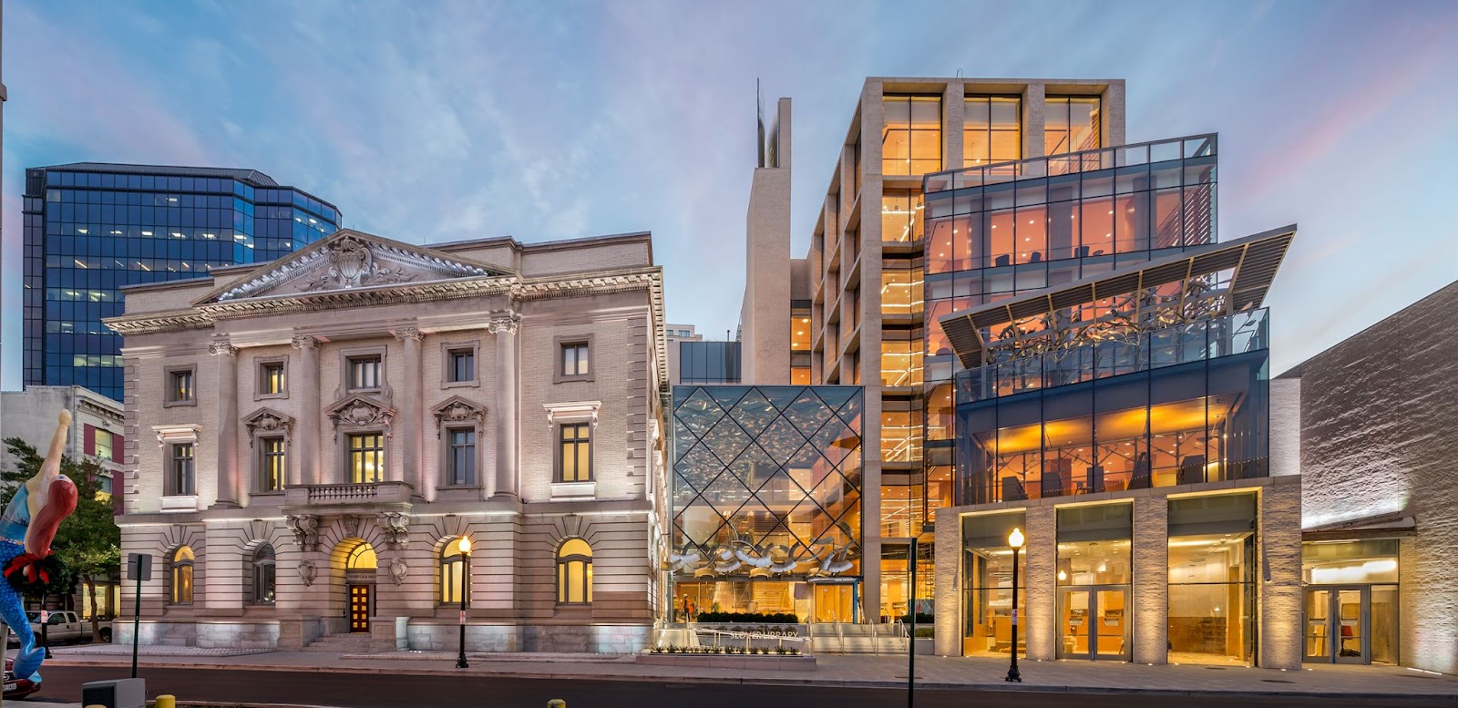
The renovated Slover Library (Peter Aaron Architectural Photography)
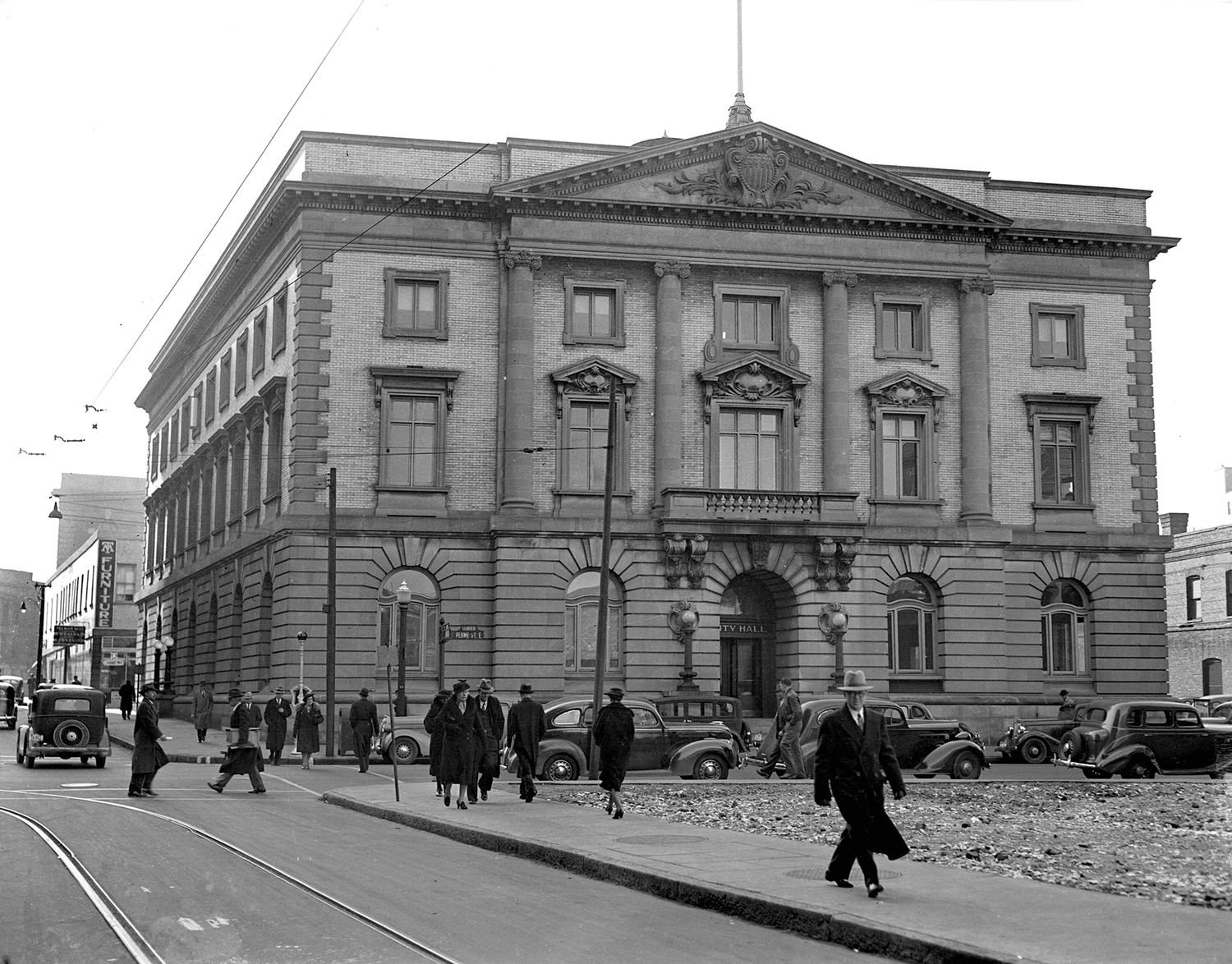
The original building in 1938
Since 2017, our students have been conducting a pioneering research in the SMC archive. They study the dark chapter of the domestic slave trade that took place between Downtown Norfolk and New Orleans (ca. 1810-1862). Slowly but persistently, they create a database of about nearly 20,000 African-Americans, once sold at and shipped from our home place.
I will expand on this historical project in another blog post. Until then, you may watch and read local TV (2023) and newspaper (2022) reports. You may also watch a video documentary from 2018 created by the cohort of students who started this research.